
Gorgeous and public transportation friendly! This is easily one of my favorites.
This is a LOT of mountains in one go. The three main ones are Akadake (赤岳, Red Mountain), Yokodake (横岳, Horizontal mountain?) and Tengu-Iodake (天黄岳, Yellow Mountain?). To be fair, I think 八ヶ岳 means eight mountains so…
Budget: JPY7,820 (~USD73)
- JPY3,410. Train, Shinjuku Station (新宿駅) to Chino Station(茅野駅).
- JPY1,000. Bus. Chino Station to Minotoguchi (美濃戸口).
- JPY1,000. Camping fee. Per person.
- JPY1,000. Bus. Minotoguchi to Chino Station.
- JPY3,410. Train, Chino Station to Tokyo Station.
Hike Date / Difficulty (Elevation: 2899m/9511ft)
- June 2019 (spring hike). Winter hike will be in a separate post.
- Difficulty: A nice 4 out of 5. It’s a pretty good hike, and SAFE.
- Route below is around 15km, with an elevation elevation change of ▲1967m/ ▽1223m
- PDF Map Link
When to GoThroughout the year! BUT definitely bring axe, at least a 10 point crampon (spikes won’t cut it) and full winter gear should you do it in winter.
Special Notes- Weather check: English / Japanese
- Trailhead. A couple available, but I'll write three here.
- Sakuradaira (桜平). Google maps pin. No public transport.
- Honzawa Onsen (本沢温泉入口). Google maps pin. No public transport. There are a couple of closer parking lots (here's the closest one), but when we went in winter (January), we opted to park closest to the road to be on the safe side.
- Minotoguchi. Access as follows:
- Train, Tokyo to Chino Station.
- Trains can be the fast and expensive one (limited express), or the slower yet cheaper one. Make sure to select the local train. I use Hyperdia to un-tick the expensive trains (limited express/bullet trains).
- Bus, Chino Station to Minotoguchi.
- No need to take the earliest train, as the bus may leave at 9:30am, so time it for that. Check the website for the schedule ahead of time. (It’s all in Japanese, so if you can’t figure it out just leave a comment and I’ll check the updated info for you.)
Bus Schedule, Chino Station (茅野駅) < > Minotoguchi (美濃戸口)- Since the start time can be a bit late, please make sure you time yourself correctly plus consider the weather. On our winter hike, we ended up hiking until 9pm and it was terrifying.
- Mountain huts.
- Paid. There are huts at the top and at the ridges, which are around JPY5,000 to JPY7500 I think for an overnight stay (add about JPY1,500 per meal). The camping spots are a lot lower, and will cost JPY1,000 per person.
- Free. None that I can see.
- Camping. None at the ridge, but spots are available before the assault to the top, which is still a couple of hours away.
ItinerarySaturday- 5:16am. Take train from Shinjuku Station to Chino Station.
- 8:48am. Arrival at Chino Station. Cross to the other side, and you’ll see the bus stop. First, go to the ticketing office (google map pin) and buy the ticket for JPY1000. Then upon exiting the ticket office, the bus stop is around 10 meters to your right. Look for the sign that says Minotoguchi (美濃戸口).
- 9:25am. Take bus to Minotoguchi.
- 10:03am. Arrive at trail head, fill up the hiking form, and head out!
- Start hike.
Sunday- Start hike. *adjust time depending on the bus schedule that you want to board. Last bus at 4:20pm*
- It's about 140 minutes to go back down from the camp point in the map above. In our case, we wanted to take the 11:20am bus, so we left around 8am, and just waited in the hut at the trailhead for the bus.
- 11:20am. Take bus from Minotoguchi to Chino.
 |
The loooong line of bags. We just had to put our bags to save the spot for the bus.
|
 |
| It was a relatively flat walk until we got into the mountain hut / camp spot, and then it was a straight assault up. This is me looking back down at the said camp spot. |
 |
| The rocky trail up. This is shot of a supportive boyfriend. |
 |
| The steep ascent! |
 |
| Summit marker for the highest point in the Yatsugatake range - Akadake. |
 |
| Another summit marker haha. |
 |
| The mountain hut right next to the summit. |
 |
| A surreal experience - a rainbow in the mountains! That's me standing right in the middle of it. |
 |
| A little bit past the mountain hut is this map that shows the surrounding mountains. |
 |
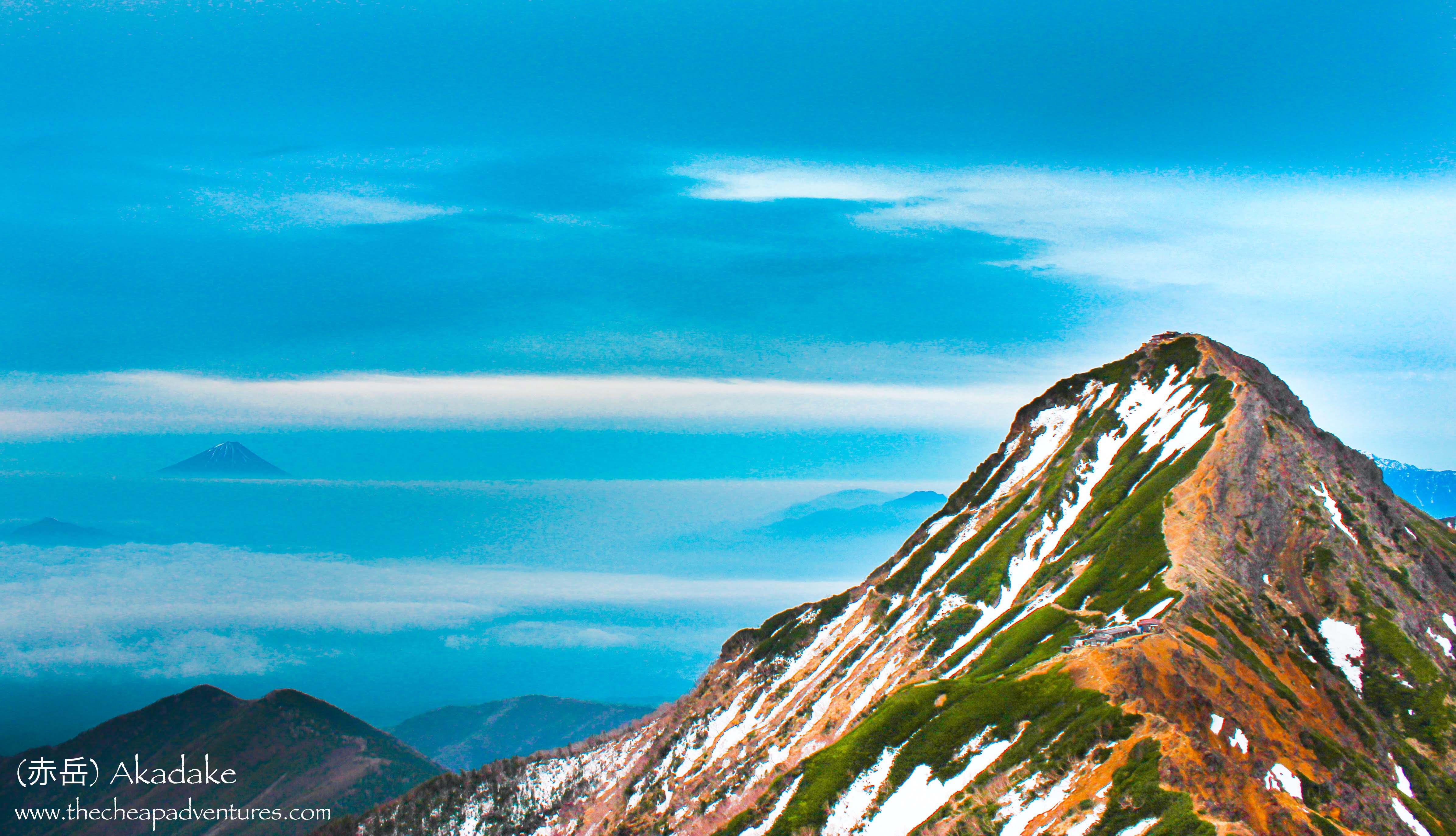
| Looking back at Akadake. |
 |
| Back at the camping spot. Plenty of tables outside, but also plenty of hikers so save your spot! |
Sorry, not a lot of pictures as I didn't take a lot of pictures before launching this blog.


Comments
Post a Comment
Comments are like mail in my postbox. Such a nice surprise. ^__^